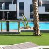
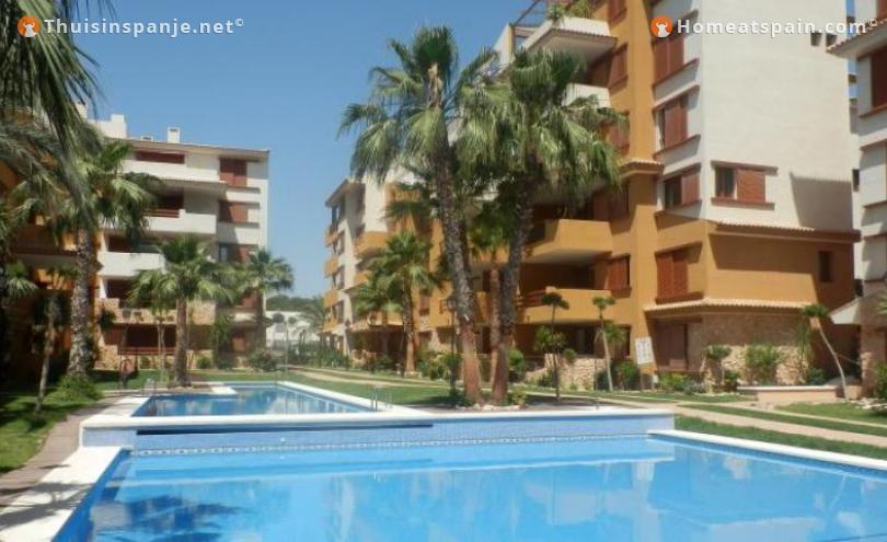

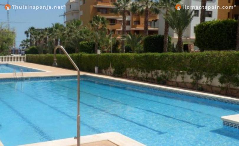
Orihuela Costa on the Costa Blanca.
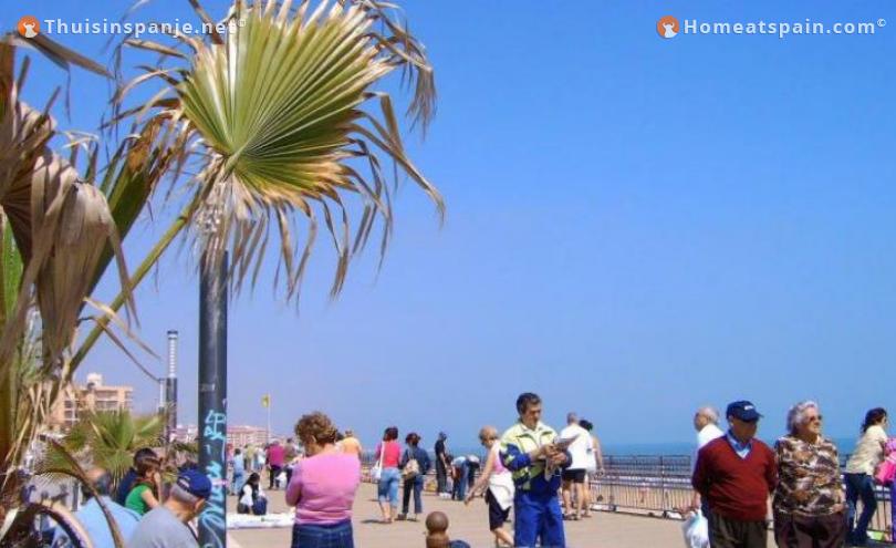
Orihuela Costa is located on the Spanish east coast near the town of Orihuela, which itself is 20 km inland and is the coastal area of the municipality of Orihuela. This coastal area is called Orihuela Costa and is a part of the municipality of Orihuela. The coastline of Orihuela-Costa stretches for a length of 16 km and is bordered to the north by the Spanish port of Torrevieja and in the south by the autonomous region of Murcia. There are 57 urbanisations, 4 golf courses and 2 marinas on the Orihuela Costa. Orihuela Costa is internationally known for its playas with beautiful white sandy beaches and clear water, creeks (calas), which are interspersed by high steep cliffs (acantilados). Several beaches in Orihuela Costa have been awarded the Blue Flag.
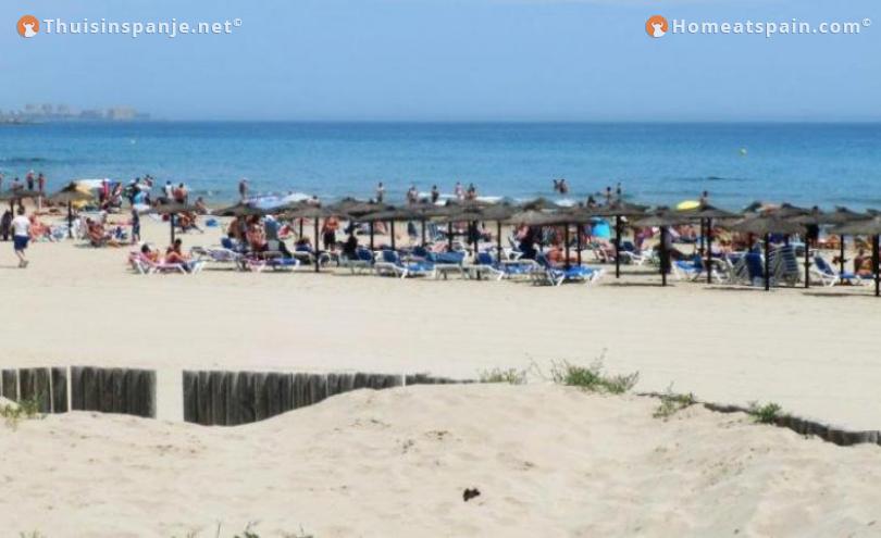
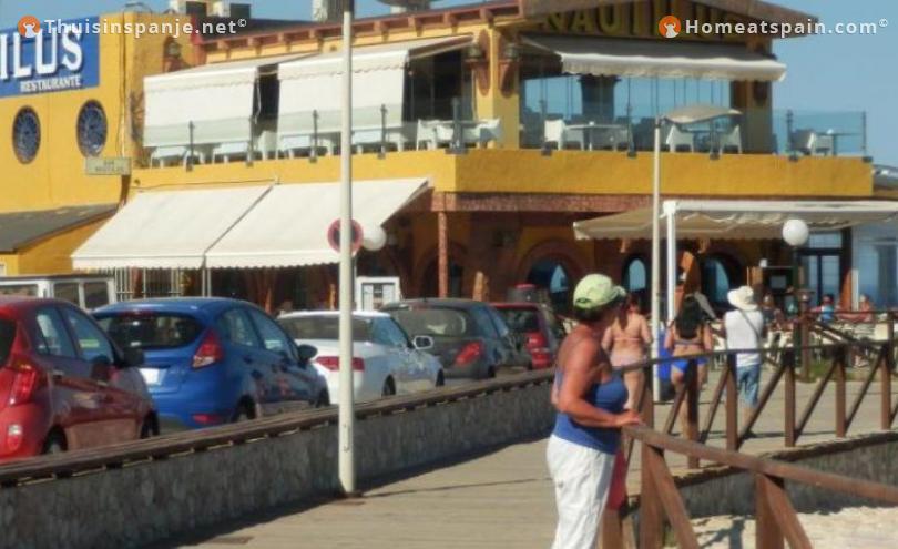
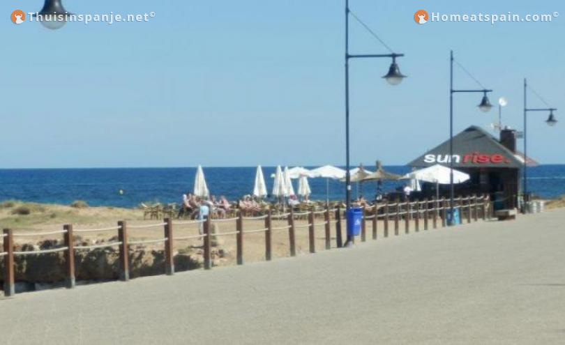
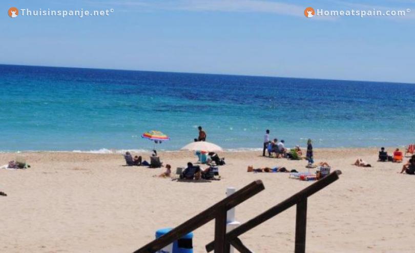
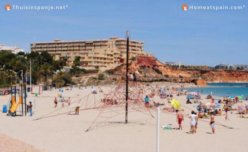
Orihuela Costa has beautiful white sandy beaches with clear water. Many sandy beaches have been awarded the prestigious Blue Flag because of the availability and presence of many facilities, such as ramps on some beaches, lifeguard towers, first aid stations and showers. Besides the sandy beaches there are many creeks (calas). The sandy beaches and creeks are also alternated by high steep cliffs (acantilados).
Living climate
Due to the absence of heavy industry and the presence of the large salinas (salt lakes) in the area, the air in the region is known as very clean. The area is therefore popular with the elderly and the sick with all kinds of chronic health complaints. It is said that the environment promotes health because of the relatively high concentrations of iodine in the air due to the presence of the salinas. In the area are many clinics for cardiovascular disease, rheumatism and skin conditions.
Golf courses
Between the urbanizations of Orihuela Costa there are four 18-hole golf courses with a total of 72 holes and an area of 1,700,000 m². At these internationally recognized golf courses, important European golf tournaments regularly take place. These four courses are successively:
- Campo de Golf Villamartín
- Campo de Golf Las Ramblas de Orihuela
- Real Club de Golf Campoamor
- Las Colinas Golf
At Orihuela Costa you can distinguish 6 important sandy beaches.
Punta Prima
Punta Prima is the south-eastern part of the municipality of Orihuela Costa, which in turn is part of the municipality of Orihuela on the Costa Blanca in the province of Alicante in the Spanish autonomous region of Valencia. Punta Prima is located about 5 km south of the port city of Torrevieja on the Spanish east coast.
In 2010 Punta Prima had 2525 inhabitants (INE 2010). Punta Prima also signifies the beach of the neighborhood. The same-named white sandy beach Punta Prima is located in the north of a series of six beaches of the municipality of Orihuela Costa and is bordered to the north by the most southerly beach Playa De Los Náufragos. town of Torrevieja and in the south at Playa Flamenca beach. It has a length of 170 meters and a width of 14 meters. The beach is accessible via slopes and stairs. From July 2010 Punta Prima has a lift on the beach to bridge the difference in height of 7 meters. Punta Prima is the only beach within the autonomous region of Valencia, which has a lift on the beach. Furthermore there are on the beach, among other things, ramps to the sea, a lifeguard tower, first aid post and parking.
Punta Prima is bordered to the north by Rocío Del Mar, La Campana in the west and Alameda Del Mar in the south. In the east Punta Prima is bordered by the Mediterranean Sea. The southernmost suburbs of the port city of Torrevieja are just a stone's throw north of Punta Prima. Furthermore, Punta Prima is located south of the N-332 motorway, which is parallel to the Spanish east coast.
Playa Flamenca
Playa Flamenga is the name of an urbanization and sandy beach in the municipality of Orihuela Costa within the municipality of Orihuela on the Costa Blanca in the province of Alicante in the Spanish autonomous region of Valencia. Playa Flamenca is located about 7.5 km south of the port city of Torrevieja on the Spanish east coast. In 2010 Playa Flamenca had 3001 inhabitants. The urbanization Playa Flamenca got its name because the initiators of building projects in the eighties of the last century came from Flanders, Belgium. Playa Flamenca is divided into two parts, namely Playa Flamenca I and Playa Flamenca II.
The white sandy beach Playa Flamenca is located in a series of six beaches in the municipality of Orihuela Costa and is bordered to the north by the beach Punta Prima and in the south by the beach La Zenia. It has a length of 150 meters and a width of 16 meters. The two sandy beaches La Mosca and La Estaca are part of Playa Flamenca. Last-mentioned sandy beach La Estaca has been awarded the Blue Flag.
Playa Flamenca is bordered to the north by the beach Punta Prima, Las Calas in the west and La Zenia in the south. In the east lies Playa Flamenca on the Mediterranean. The N-332 motorway is parallel to the Spanish east coast and traverses Playa Flamenca. On the northwest side is the AP-7 motorway. Since 2007 Playa Flamenca has a new boulevard.
La Zenia
La Zenia is the name of an urbanization and sandy beach in the municipality of Orihuela Costa within the municipality of Orihuela on the Costa Blanca in the province of Alicante in the Spanish autonomous region of Valencia. La Zenia is located about 8 km south of the port city of Torrevieja on the Spanish east coast. In 2010 La Zenia had 1815 inhabitants.
The white sandy beach La Zenia is located in a series of six beaches in the municipality of Orihuela-Costa and is bordered to the north by the beach Playa Flamenca and in the south by the beach Cabo Roig. It has a length of 350 meters and a width of 60 meters. There are also on the beach, among others, ramps to the sea, a first aid post and special access for the disabled.The beach is surrounded by numerous restaurants and hotels.
La Zenia is divided into two parts, namely La Zenia and La Zenia II. La Zenia is bordered to the north by the urbanizations Playa Flamenca, Montezenia in the west and Cabo Roig, Las Amapolas IV and San Jose IV in the south. In the east lies La Zenia on the Mediterranean Sea.
The N-332 motorway is parallel to the Spanish east coast and traverses La Zenia. On the northwest side is the AP-7 motorway. The entrance of La Zenia via the motorway AP-7 towards Murcia, has the special feature, that it does not pass the unique toll house of the AP-7, so this part of the AP-7 is free, while the AP-7 continues in this area is mainly a toll road.
Cabo Roig
Cabo Roig is the name of an urbanization, sandy beach and marina in the municipality of Orihuela Costa within the municipality of Orihuela on the Costa Blanca in the province of Alicante in the Spanish autonomous region of Valencia. Cabo Roig is located about 9.5 km south of the port city of Torrevieja on the east coast of Spain. In 2010, Cabo Roig had 700 inhabitants. Cabo Roig means literally nibbled cape from the Spanish. Cabo is the Spanish word for Cape, and Roig comes from the Spanish verb, rudder, which means nibbling.
The homonymous white sandy beach Cabo Roig is located in a series of six beaches in the municipality of Orihuela Costa and is bordered to the north by the beach La Zenia and in the south by the beach Campoamor. It has a length of 420 meters and a width of 18 meters. The beach is accessible via stairs and slopes. Furthermore, there are a lifeguard tower, a first aid post and special access for the disabled on the beach. The beach is surrounded by numerous restaurants and awarded the Blue Flag since 1992.
The construction of this urbanization began at the end of the 1950s, but the plan was partially rejected until 1972. The urbanization was built around an old defense tower from the 16th century. Cabo Roig is bordered to the north by the urbanizations La Zenia, Las Amapolas IV in the west and Aquamarina in the south. In the east lies Cabo Roig on the Mediterranean. Cabo Roig is located south of the N-332 motorway, which is parallel to the east coast of Spain. On the northwest side is the AP-7 motorway.
The marina of Cabo Roig has 207 berths, for yachts with a length of up to 12 meters and a draft of 1 to 3 meters. The marina has many facilities including a dry dock, crane of 3 tons (3000kg), work and repair place. There is also a restaurant, bar and water sports school. There is the possibility of diving, jet skiing, windsurfing and wakeboarding. The marina has been modernized for an amount of more than 2 million euros.
Striking is the old defense tower of Cabo Roig, built in the 16th century. Originally a military defense against attacks by pirates and Berbers. The tower is made of masonry stone and has two floors and a terrace on top. The tower has been on the list of monuments since 1949 and has been completely restored to its former state. Urbanization Cabo Roig is built around this tower, which is now part of a restaurant.
Campoamor
Dehesa De Campoamor is the name of an urbanization, sandy beach and marina in the municipality of Orihuela Costa within the municipality of Orihuela on the Costa Blanca in the province of Alicante in the Spanish autonomous region of Valencia. Dehesa De Campoamor lies about 12.8 km south of the port city of Torrevieja on the Spanish east coast. In 2010 Dehesa De Campoamor had 868 inhabitants. Together with Lomas De Campoamor (265) a total of 1133 inhabitants.
Dehesa De Campoamor literally translated from Spanish into the pasture of Campoamor. Dehesa is the Spanish word for pasture and Campoamor refers to the Spanish poet and writer Ramón De Campoamor, who was governor of the province of Alicante in 1854 and through his marriage with Guillermina O'Gorman bought the area Dehesa de Matamoros and changed the name to Dehesa the Campoamor.
The white sandy beach Campoamor is located in a series of six beaches in the municipality of Orihuela-Costa and is bordered to the north by the beach Cabo Roig and in the south by the beach Mil Palmeras. It has a length of 650 meters and a width of 20 meters. Furthermore, there are a lifeguard tower on the beach, a first aid post, ramps and a special access for the disabled, a restaurant and a hotel. In summer the beach is filled with tourists from Spain (mainly from Murcia, Alicante and Madrid) and from abroad (mainly from Germany and Great Britain).
The beach of Dehesa De Campoamor is further subdivided into:
Playa De La Glea also called La Playa Grande (the big beach). This is the largest beach and has been awarded the Blue Flag and Q Flag, both tourist awards. This beach mainly visits foreign tourists and residents from Orihuela-Costa and Torrevieja. In 2010, an oasis of palm trees with children's play objects was placed.
Playa Barranco Rubio, also called La Playa Pequena (the small beach). Traditionally, this beach is mainly visited by residents of Murcia and Alicante and bathers who visit Dehesa de Campoamor annually. This is more of a family beach.